
MASTERPLAN
STAGE BY STAGE
Planned for 40,000 Residents • 10 Stages Sold Out
A PLAN WITH
A TRACK RECORD
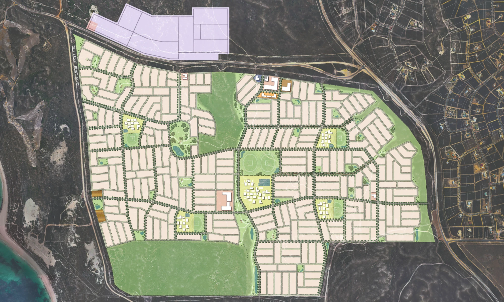
Lancelin South is organised around a handful of precincts, each built around a different part of daily life: a coastal residential core close to the beach, a town-centre anchoring local retail and services, and a light industrial/tourism precinct supporting local employment, while conservation areas and open space buffer the estate from Indian Ocean Drive and preserve the natural landscape between precincts.
Conservation Area
Local Centre
Medical Centre
Aged Care
Community Centre
Primary School
High School
Future Lancelin SLSC
Emergency Services Headquarters
Light Industrial Zoning
Neighbourhood Centre
District Open Space
Primary School
Childcare Centre
Childcare Centre
Conservation Area
Landscape buffer to Indian Ocean Drive
Tourism/Retail
Local Centre
Golf Course
What’s Planned Across the Estate
Everyday
- Local Centre ×2
- Neighbourhood Centre
- Primary School ×2
- High School
- Childcare Centre ×2
Recreation
- 9-Hole Golf Course
- District Open Space
- Conservation Area
- Beach Access Path
Health & Care
- Medical Centre
- Aged Care
Community
- Community Centre
- Future Lancelin SLSC
- Emergency Services HQ
Employment
- Light Industrial Zoning
- Tourism / Retail